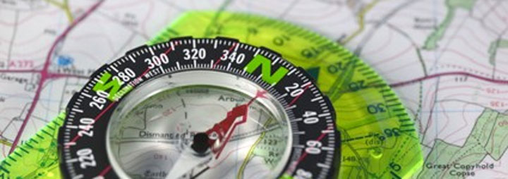
For many years motorcyclists have traveled the worlds continents simply for the sake of adventure. In the early years navigation was by compass, paper map and word of mouth and lost was not something that was feared nor often even part of the vocabulary of the traveler. No matter how we travel or where we want to go, the adventure is in the journey.
Today many of us want the adventure of motorcycle travel to exotic and mysterious places we haven't been before. But, reality usually dictates that we do our Adventure Touring with some schedule in mind. That usually means relying upon the knowledge of people like Helge Pedersen to show us the way. At GlobeRiders we use GPS technology to deliver that knowledge. There is an amazing amount of information available to assist us in getting from where we are to where we want to be - anywhere in the world. Satellite Imagery, Global Positioning System data and land-based radio triangulation are all available to us as we explore new and exciting countries - or just over the hill from home.
Whatever the adventure, since most of us don’t quite have a “10 Years On Two Wheels” explorer in us, we can use today's tools to reduce the anxiety of getting lost, keep us on schedule and ultimately improve our travel experience. Arguably the one electronic device that has enabled adventure travel the most is the Global Positioning System receiver or GPS for short. As commercial devices, GPS’s have developed significantly over the past two decades. From handheld devices with simple LCD displays that showed only the Latitude and Longitude coordinates of your location, to today’s sophisticated units that have onboard digital road maps of the world’s countries and can auto-route from one location to another with a minimal amount of input from us.
Before we take a closer look at the more sophisticated GPS’s we use, let’s do a short review of the basic GPS data types that are most important to Adventure Touring.
Waypoints: For our purposes a waypoint is a point on the earth defined by latitude and longitude coordinates.
Routes: In today’s GPS context, a route is a path calculated by the GPS between a minimum of two waypoints using onboard maps that contain information (routing data) that the GPS uses in the calculation. Since a Route is calculated, no two GPS’s will produce the same Route given a start point and end point unless they are calculated on the same model of GPS using the same exact map data with the same exact routing preferences – and that is rare!
Tracks: Since the beginning, commercial GPS’s have been able to record the path we traveled by setting points (latitude, longitude) along the way. These points (track points) are represented on the GPS display by a line connecting them from start to finish. Once a track is recorded the direction of travel for a track is determined by the time-stamp associated with each point along the path.
As you can see there is a significant difference between Route’s and Track’s. So, are Route’s really useful? Well, sometimes, but not when you want to ensure everyone follows the same path – then we need Tracks.
Digital Maps: Most modern GPS’s support pre-installed or installable digital maps. The two fundamental types of digital maps are referred to as Raster or Vector maps. Raster maps can be made from arial or satellite imagery, scanned paper maps or any image that is earth coordinate calibrated. Vector maps are typically created using map editing software, or drawn, and have earth coordinate data associated to the drawn lines that represent roads; or any other feature the author wants to place on the map. The advantage of vector maps is that they can also have routing data associated to the roads which will enable the GPS to create a route based on a start point and an end point. Maps are only as good as the author who created them. There is not one type of map that is better than another but routable vector maps are more convenient since you can both auto-route and use waypoints and tracks to navigate. All of the GPS unit’s we recommend minimally have a World Map available, either as a pre-installed base map or as an optionally installed map, that provides some visual reference of where you are anywhere on the globe.
As an Adventure Touring company, we must provide our clients with reliable GPS data in order to ensure that everyone has a safe and enjoyable tour experience. Although we have knowledgeable guides on our tours, we want our clients to be self sufficient and have, or learn, good navigation skills. Since all commercial GPS's are not created equal, the only reliable navigation data that can be share between them are Tracks and Waypoints. When we develop a Tour we provide our Waypoint and Track data in the industry standard format know as GPS Exchange Format (GPX). Most, if not all, commercial GPS’s can read the GPX data format – if not, those GPS’s are of little use in the Adventure Touring world.
Given the above fundamentals, at GlobeRiders we have invested hundreds of hours in evaluating commercial GPS devices and continue to do so in order to be in a position to recommend which GPS’s will best suite our and our client’s needs while on tour.
Over the years the Garmin Company has provided a few GPS models that have met the requirements for data import/export and usability on a motorcycle when Adventure Touring. One of the reasons for Garmin’s dominance in this market segment is due to the continually growing map library; both commercial and Open Source (free). Not to say that there are not other GPS manufacturers that make good GPS's. But, when you consider the availability of maps and the fact that Garmin produces reliable GPS devices with new technology and proven navigation features that support Adventure Touring, we currently only recommend Garmin GPS's.
Of the units we recommend, the Garmin GPSMAP 276C and GPSMAP 478 units ,actually Marine Chartplotters, have been in the Garmin product lineup of many years. These units have been the benchmark for all others due to their capability to navigate anywhere on the earth, with or without routable maps as well as withstand the rigors of motorcycle use. Although fundamentally sound, these units are based on older technology. Their GPS receivers are not as capable of holding a GPS signal as are some newer units and they are limited by their older proprietary removable storage cards. In addition, these units are almost at the end of their production life. None the less they are very good GPS's.
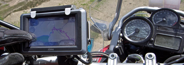
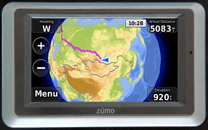
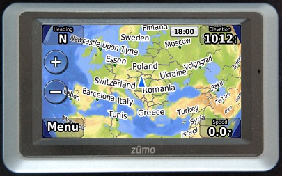
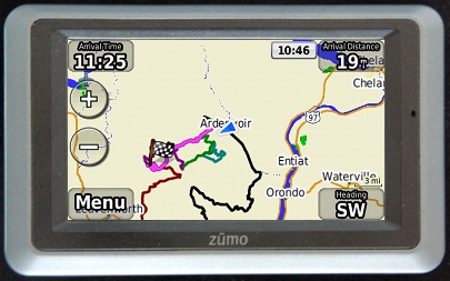
Relatively new to the Garmin line are the zumo 660 and zumo 665 models that are pictured here. These models have only recently been added to our recommended-list due to software feature enhancements by Garmin. These models have touch screen interfaces (no hardware buttons) and now provide the necessary Waypoint and Track navigation fuctionality for Adventure Touring. In addtion these units include Bluetooth wireless support for cellular phones and stereo headsets. They will play MP3 music and Audible Books and the zumo 665 even has XM Radio support. None of these features have anything to do with Adventure Touring but do highlight the sophisticated high-sensitivity GPS units of today. They don't have all of the navigation features/functions of their Marine Chartplotter cusins mentioned above, but they do have the features needed for Adventure Touring. They can also carry very large amounts of trip data compared to the GPSMAP units including, but not limited to, additional maps, Waypoints and Tracks. This enhanced storage capability is due to the use of industry standard removable flash storage in the form of microSD Cards and far exceeds the GPSMAP units storage capabilities and at a lower cost.
Let's look at a few of the features that I've been describing.
Waypoints as noted earlier, can have additional information associated with them that can aid in getting you to where you want to go. They can have Addresses, Phone Numbers and Symbols that show on the map to help us quickly identify a feature or location. They can also have proximity alerts that can be used to bring your attention to the fact that you are within a selected range of the Waypoint. Garmin also supports what is called Custom Points of Interest (POI's). These special Waypoints have even more data associated with them than the normal Waypoint. They can have rather long text descriptions that might provide critical travel information or just an historical overview of an interesting place. Garmin GPS's treat Custom POI's a bit differently than Waypoints in several ways. For example, POI's will only show on the map when you are within 50 miles of them and at certin zoom levels.
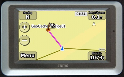
With the latest software update for the zumo 660 and zumo 665, Tracks can be used in two ways and they are not mutually exclusive. Unique to these units, Tracks can be imported and automatically converted to Routes - up to 20 in the active list. These Routes can be used just as you would any Custom Route with the exception that they should not be allowed to recalculate when in use. This would change the route and therefore you would lose the explicit path that was the original Track. To avoid this potential while a route is active you would simply disable the recalculation option. The benefit of the Track to Route conversion is that you can receive navigation instructions even if part of the route is traveling over areas of the map where there are no visible roads. The second way that Tracks can be used is by importing them as Off Road Tracks - up to 15 in the active list. This feature will allow you to import up to 15 Tracks which you can show on the map as though they were part of the map features. These Off Road Tracks can be set to show or not show on the map and they can have their color changed to differentiate them in some way. They can also have a unique name.
A good GPS is a fundimental tool for our purposes and those that we recommend are more than capable of helping you navigate anywhere on the earth. There are long-standing debates regarding the advantages of one GPS over another. Touch screens are better, or not, than mechanical buttons. Screen brightness is better on one model than another and size does matter. I love a good technology debate but I'm afraid it would be rather one sided here.
We continually evaluate GPS models from many manufactures in an effort to be knowledgeable in the technology and to enable us to recommend the most appropriate GPS’s for Adventure Touring. If you have comments or questions please send me an email by visiting our Contacts page.
Thanks for your attention.
Sincerely,

Dan Townlsey - Partner/Guide
All Things GPS
|