One of our excellent sponsors is Touratech. We're fortunate to enjoy the support of both the parent company, Touratech AG (Germany) and Touratech-USA (right here in Seattle, Washington). In thinking about ways to make the Live!Journal more compelling, the idea of real-time satellite tracking was proposed. Touratech generously offered to sponsor the hardware and web gateway needed to do the job. What makes it all work is Touratech's QV4 Professional GPS and Navigation software.
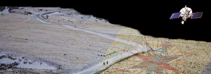
On the current IndoChina Adventure, Helge's motorcycle is equipped with a SkyWave DMR-200D transceiver. This transceiver consists of a GPS (Global Positioning System) receiver and an INMARSAT (INternational MARitime SATellite) transmitter.
The GPS receiver continuously calculates Helge's position using timing signals from the intermediate circular orbit GPS satellite constellation maintained by the United States Department of Defense. Every 30 to 60 minutes, the DMR-200D's on-board transmitter uploads a position "fix" to one of the nine satellites orbited by INMARSAT. In order to reduce redundant data, a position fix is only sent if the motorcycle is actually moving, nothing is sent when the bike is parked.
When the satellite receives a position fix, it transmits the data to a SkyWave ground station, where it is added to a position file. Each time you visit or refresh this webpage, the position file is "fetched" from Touratech's server, and new position fixes (the yellow "dots" you see in the image below) are added and displayed. The position fixes are rendered in a Google Maps frame, where you can pan and zoom, and have the ability to select a "regular" road map (if available), a satellite image, or a hybrid combination of the two.
We will be using Google Maps a lot more on our site so we encourage you play around with the map below and learn how it works - you can't hurt anything - so give it a go. You can click and hold on the map and drag it to pan around. You can zoom-in and zoom-out using the controls, or you can just double-click on the location you want to zoom on. You can even change map views. Try selecting the Satellite view or the Terrain view.
The map below is tracking the current tour or expedition that we have underway. It shows the track-to-date and current position of the group. If no tour is currently in progress, the map will show the last position and track of the most recently completed tour.
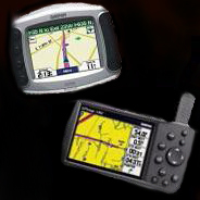
Of course, none of the riders can view this rich set of position data, unless they are parked, have an internet connection, and a browser-enabled device, such as you have while viewing this page. Instead, each has a Garmin portable GPS receiver, loaded with maps, waypoints and tracks that we have logged on pre-runs or previous tours. Our current favorite is the Garmin GPSMAP 276C (for North American riders) or the GPSMAP 278 (for European riders).